
While there’s no hurricane threat in Sebastian, National Hurricane Center (NHC) forecasters predict that the storm will bring significant rainfall and gusty winds to our area.
Sebastian is currently under a Tropical Storm Watch. A Tropical Storm Watch is issued when there’s a chance of winds of 39 to 73 mph or stronger within 48 hours. This could lead to storm surge or coastal flooding. A watch does not mean that tropical storm conditions will occur. It only means that these conditions are possible.
Early projections indicate that Sebastian could receive up to 4 inches of rain, accompanied by winds ranging from 15 to 30 miles per hour. However there are times when wind speeds could be higher.
To minimize property damage, residents are urged to bring loose outdoor items, such as toys, sports equipment, and lawn furniture, indoors or secure them tightly.
Questions about the need for storm shutters have been circulating among residents. We cannot provide guidance on that, so it is recommended that individuals contact their insurance companies on this matter. We can tell you that most residents do not have shutters up. However, ask your insurance company.
Additionally, now is not the ideal time to trim trees or bushes, as debris can clog stormwater drains and contribute to flooding.
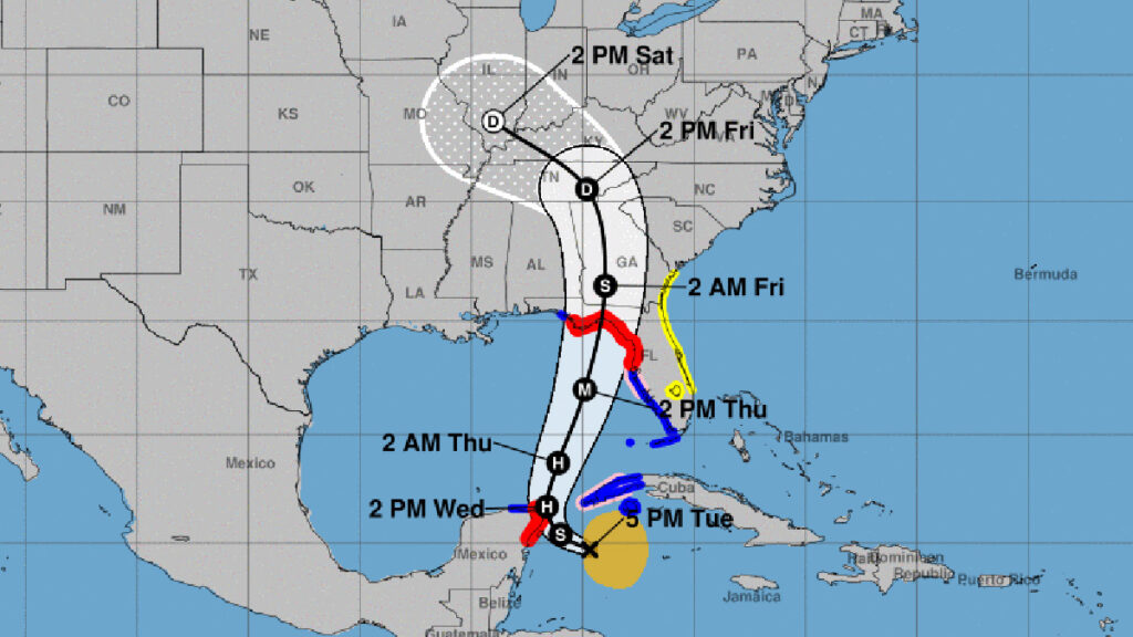
As Helene continues its path, it is expected to intensify and potentially reach hurricane strength before making landfall. Tropical storm conditions are anticipated for portions of western Cuba and the northeastern coast of the Yucatan Peninsula, with hurricane conditions possible.
“Helene is expected to rapidly intensify over the eastern Gulf of Mexico and be a major hurricane when it approaches the northeastern Gulf Coast on Thursday,” NHC said.
Sebastian Daily will provide updates as the National Hurricane Center releases new information.

